CSU recognized among PH’s major geospatial research contributors, tops Mindanao
 :
: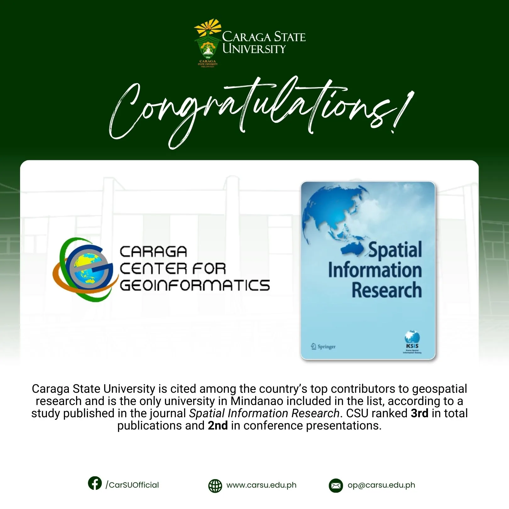
Caraga State University (CSU) is cited among the country’s top contributors to geospatial research and is the only university in Mindanao included in the list, according to a study published in the journal Spatial Information Research. CSU ranked 3rd in overall publications and 2nd in conference presentations.
“This recognition highlights CSU’s unique role in advancing geospatial research, not just for Mindanao but for the entire Philippines,” said Engr. Arnaldo C. Gagula, Chief of the Caraga Center for Geo-Informatics (CCGeo). “As the only Mindanao university in the list, we carry the responsibility of ensuring that geospatial science serves communities across underserved regions,” he added.
The study titled “Geospatial Information Research in the Philippines: A Bibliometric Analysis,” authored by Dr. Arnold R. Salvacion, reviewed more than four decades of geospatial research output from 1978 to 2024 and identified CSU, alongside the University of the Philippines Diliman and Los Baños, as among the most productive research institutions in the field.
Flagship geospatial center
CSU cemented its role as Mindanao’s leader in geospatial innovation through its flagship research hub, Caraga Center for Geo-Informatics (CCGeo). As a platform for training, research, and collaboration, the center has spearheaded projects that integrate Geographic Information Systems (GIS), remote sensing, and geodetic technologies into initiatives addressing disaster resilience, natural resource management, and sustainable development.
Notably, the center has extended its participation beyond the region and participated in the Phil-LiDAR 1 and 2 Programs, with support from the Department of Science and Technology (DOST) and in cooperation with partner agencies and local government units.
Phil-LiDAR 1, led by Engr. Meriam Makinano-Santillan, focused on nationwide flood hazard mapping and disaster risk reduction. Meanwhile, Phil-LiDAR 2, under Dr. Michelle V. Japitana, covered agricultural resource assessment and environmental monitoring. Both produced critical datasets for Mindanao, improved disaster preparedness, and equipped the university and partners with advanced technologies and expertise that continue to drive its research today.
Beyond LiDAR, CSU scholars have published influential studies in climate impact assessments, land use change detection, and GIS-based disaster risk reduction, among others, involving the use and applications of geospatial technology. CSU has fully embraced geospatial technology, with other departments and colleges also integrating geospatial tools into their research and thereby contributing significantly to the university’s growing number of geospatial-related publications.
Engr. Meriam Makinano-Santillan spearheaded the Geo-SAFER Mindanao Program, funded by DOST-PCIEERD, which enhanced flood hazard mapping and community resilience in the region. Engr. Jojene R. Santillan also led a project funded by DOST-PCAARRD titled the Development of a Geodatabase of Industrial Tree Plantations in Caraga Region Using Remote Sensing and GIS, which provided critical data for forestry management and sustainable resource planning.
These projects, alongside numerous studies presented in international conferences and published in indexed journals, further exemplify the university’s capability to contribute solutions to pressing environmental and societal issues through geospatial science.
CSU’s reach is further strengthened by global partnerships. Through CCGeo and the Department of Geodetic Engineering, the university has established Memoranda of Understanding (MOU) with the Institute of Photogrammetry and GeoInformation of Leibniz Universität Hannover, Germany, and Universitas 17 Agustus 1945 Semarang in Indonesia. These collaborations open opportunities for joint research, faculty and student exchanges, and academic training, ensuring that CSU remains connected to the latest global advancements while contributing local expertise.
The university’s Bachelor of Science in Geodetic Engineering (BSGE) program has also played a vital role in this recognition. Students are equipped with hands-on training in the latest geospatial technologies, exposed to fieldwork and laboratory techniques, and engaged in real-world research through CCGeo projects. The students are also encouraged to participate in conferences, internships, and international collaborations, preparing them to be holistic, industry-ready, and globally competitive.
Looking ahead, CSU plans to expand its geospatial research by strengthening international collaborations and joint publications, integrating geospatial technologies into social sciences studies, and continuing to apply geospatial tools to climate adaptation, food security, urban planning, and sustainable resource management. The university also envisions modernizing CCGeo facilities and building stronger industry partnerships to ensure that research outputs are transformed into concrete policies and community applications.
With its strong research foundation, international linkages, and commitment to education, Caraga State University is poised to lead Mindanao and the Philippines into a future where geospatial science empowers communities and drives sustainable development relevant to SDG No. 4 (Quality Education), 9 (Industry, Innovation and Infrastructure), and 17 (Partnership for the Goals).